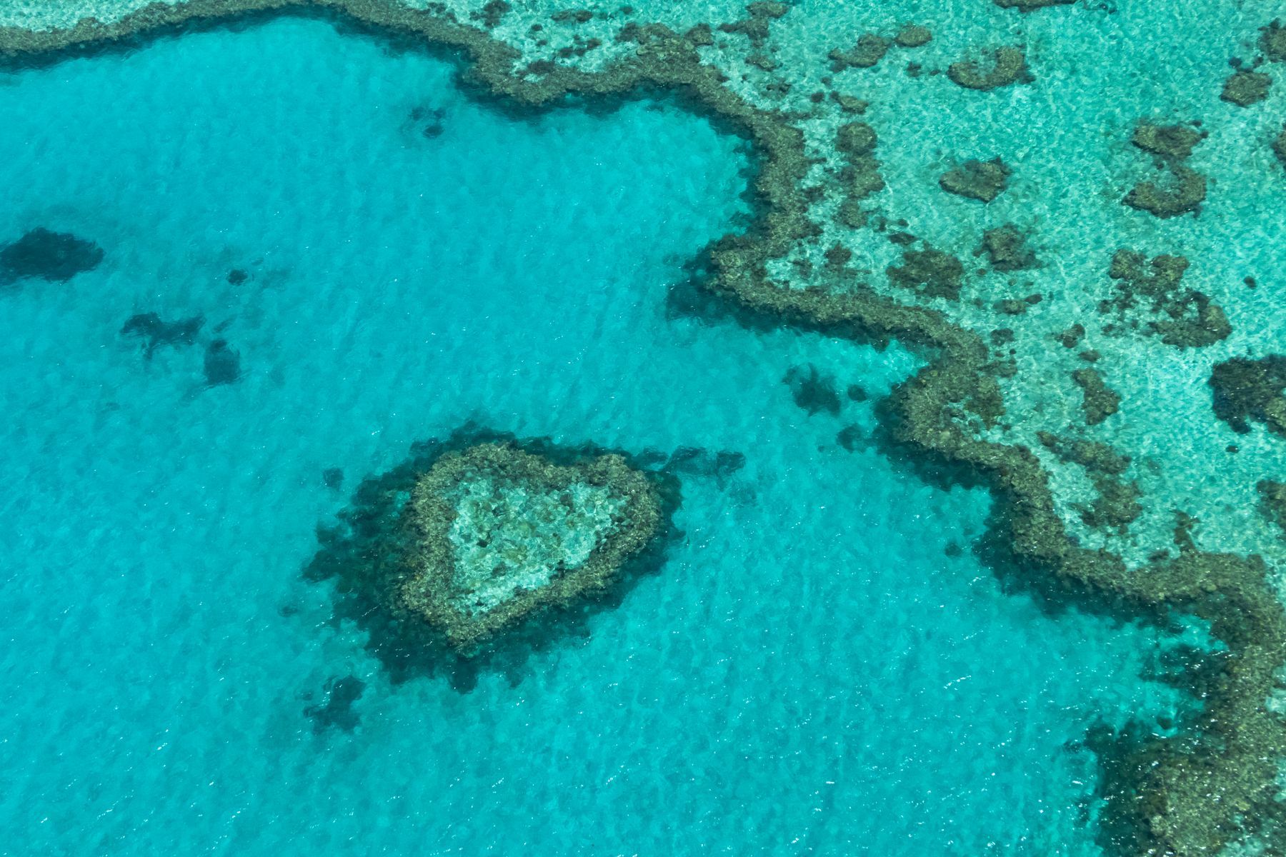
The Great Barrier Reef is the largest coral reef system on Earth, and you can reach it in under an hour from parts of the Queensland coast. This guide covers where it is, who has cared for it longest, which town to base yourself in, how to get on the water, what you will see and when, how healthy the reef really is, and how to visit without harming it.
What and where is the Great Barrier Reef?
The Great Barrier Reef is a chain of about 3,000 separate coral reefs running for about 2,300 km along the coast of Queensland, from the Torres Strait near Papua New Guinea to just north of Bundaberg. It is not one wall of coral but a maze of reefs, sandy coral cays and continental islands spread across the continental shelf.
The numbers are hard to picture. The Great Barrier Reef Marine Park covers 344,400 km², larger than Italy. The Reef Authority counts about 600 continental islands, about 300 coral cays and some 150 inshore mangrove islands. It is home to more than 1,600 kinds of fish, about 450 kinds of hard coral and six of the world's seven species of marine turtle.
The Marine Park was created in 1975, and in 1981 almost the entire ecosystem was inscribed on UNESCO's World Heritage List. Today it is managed jointly by the Australian and Queensland governments, with the Great Barrier Reef Marine Park Authority (the Reef Authority) as the lead agency.
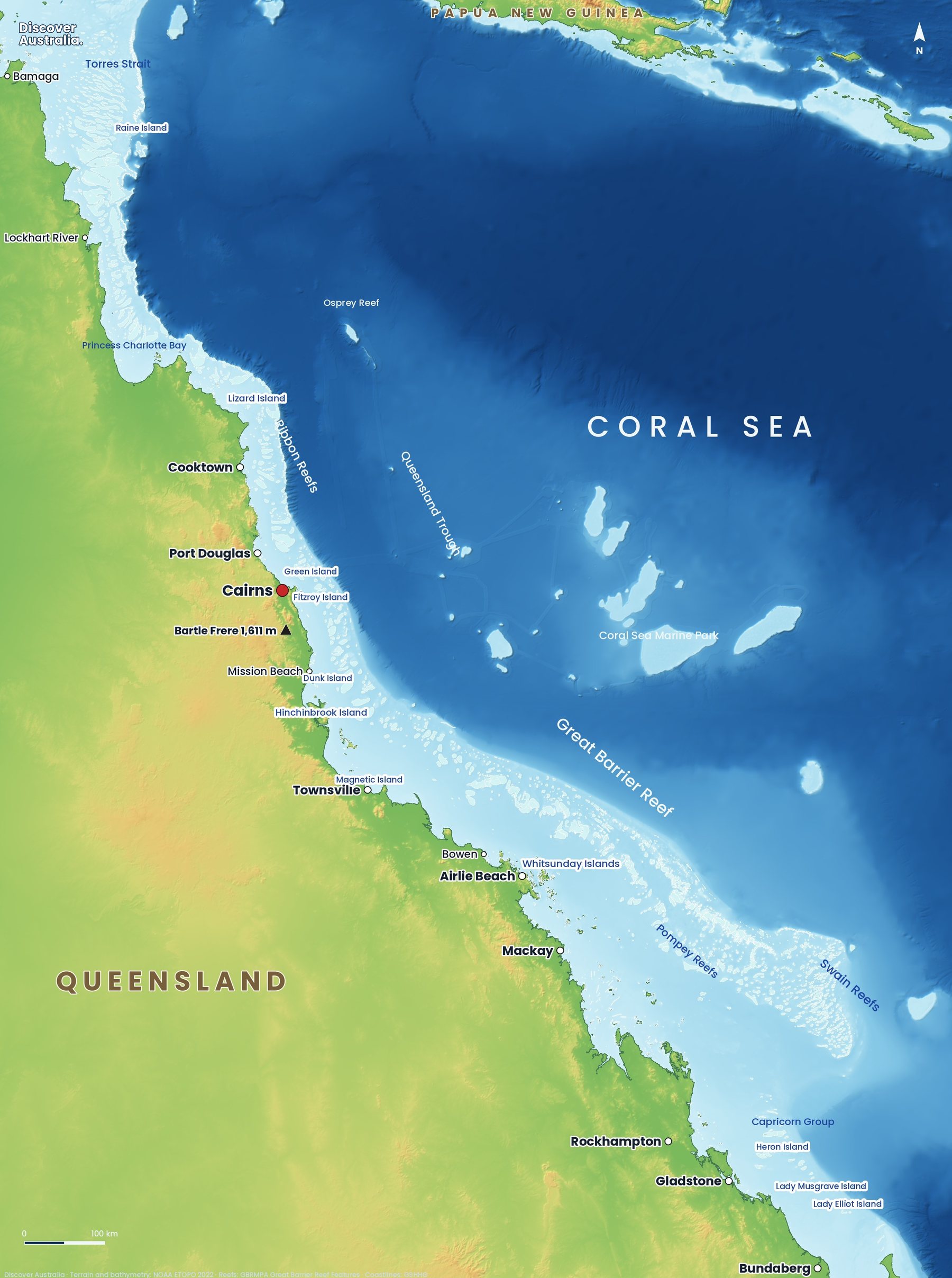
Our Great Barrier Reef map guide explains each region in more detail. In short: In the far north, the Ribbon Reefs line the edge of the shelf off Cooktown and Port Douglas. In the middle, reefs sit far offshore of Townsville and Mackay, and the Pompey and Swain reefs spread wide off the central coast. In the south, the Capricorn and Bunker groups of coral cays are close to Gladstone and Bundaberg. Beyond the reef lies the Coral Sea Marine Park, with remote atolls such as Osprey Reef.
Who are the Traditional Owners of the Great Barrier Reef?
More than 70 Aboriginal and Torres Strait Islander Traditional Owner groups have Sea Country within the Great Barrier Reef, according to the Reef Authority. Each group has its own Country, language, laws and stories, so there is no single First Nations story of the reef.
The Reef Authority describes evidence of Traditional Owners' connections to Sea Country going back about 60,000 years. Long before the reef was mapped by Europeans, it was fished, travelled and cared for, and many places on it hold cultural meaning that is not shared publicly.
That connection continues in how the reef is managed. Traditional Owner groups hold Traditional Use of Marine Resources Agreements with the Reef Authority, which set out how they hunt, fish and care for their Sea Country, and Traditional Owners work with the Reef Authority on caring for their Sea Country. As a visitor, the best way to learn is from Traditional Owners themselves, on a First Nations-led reef or cultural tour; see our guides to Aboriginal cultural tours and visiting Australia respectfully.
Where is the best place to see the Great Barrier Reef?
For a first trip, Cairns or Port Douglas gives the widest choice of outer reef trips; the Whitsundays suit travellers who want islands, sailing and beaches as well. Each gateway leads to a different kind of reef.
| Gateway | Reef you reach | Best for |
|---|---|---|
| Cairns | Outer reef pontoons, Green Island, Michaelmas Cay, Fitzroy Island | First-timers, the most trips, liveaboards |
| Port Douglas | Agincourt ribbon reefs, Low Isles | Clear outer reef water, smaller town |
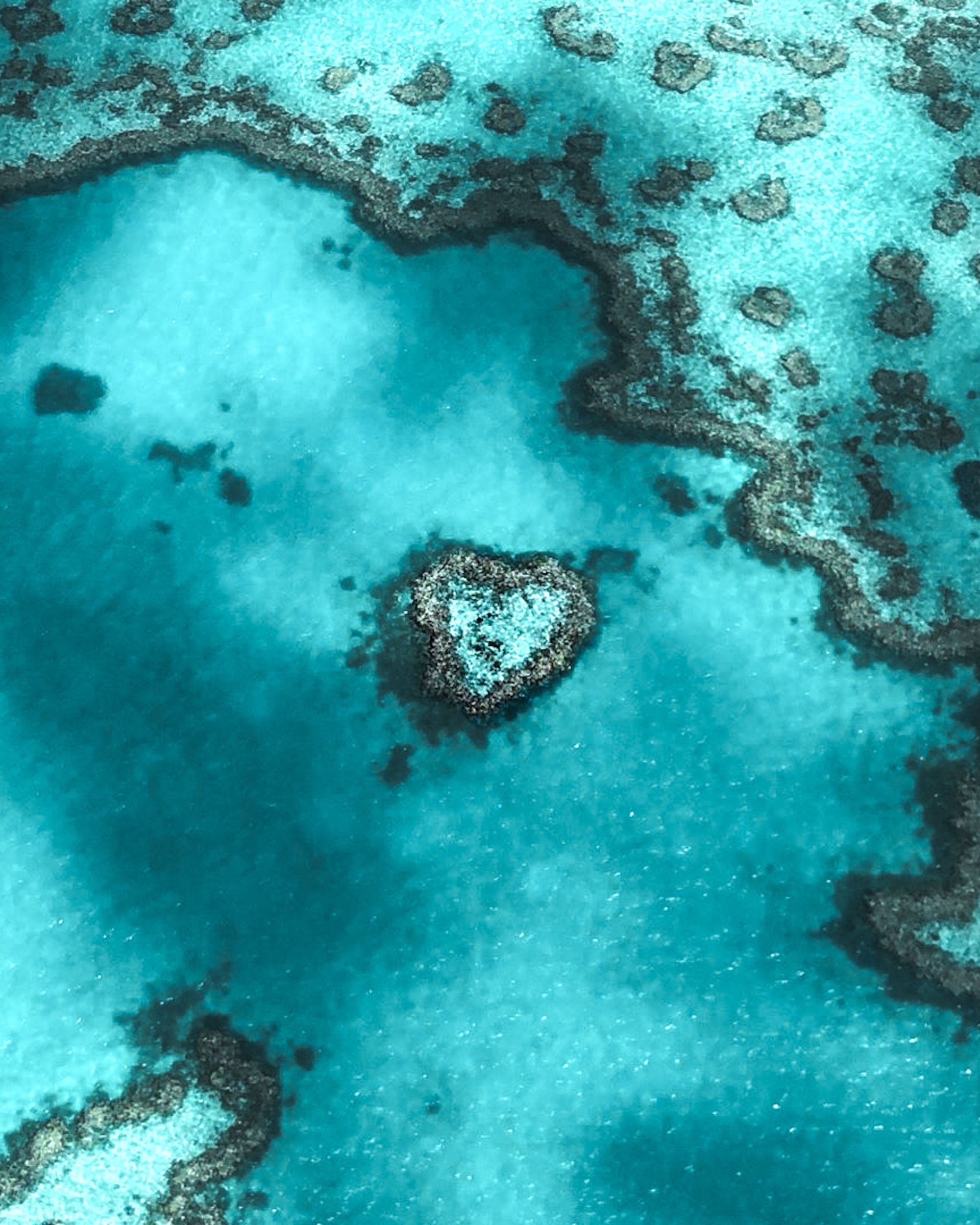
| Airlie Beach (Whitsundays) | Island bays, Hardy Reef, Heart Reef by air | Sailing, Whitehaven Beach, scenic flights |
| Townsville | Magnetic Island, SS Yongala wreck, John Brewer Reef | Shore snorkel trails, wreck diving |
| Southern reef (Gladstone, 1770, Bundaberg, Hervey Bay) | Heron, Lady Musgrave and Lady Elliot islands | Turtles, mantas, snorkelling from the beach |
Cairns also puts you next to the Wet Tropics, so you can pair the reef with the Daintree Rainforest. In the Whitsundays, the reef is further out, so many visitors spend their time sailing between islands instead; our Whitsundays guide covers how. The southern reef is quieter, and its coral cays let you walk straight off the sand into the lagoon.
How do you visit the Great Barrier Reef?
Most people visit on a day trip by boat from the mainland, but you can also stay on an island, sleep on a liveaboard or see it from the air. Pick the one that matches your swimming, your budget and your time.
- Outer reef day trips: big boats run to moored pontoons with snorkel gear, glass-bottom boats and lunch; smaller boats visit two or three sites with fewer people. Most offer an introductory dive with an instructor, no licence needed.
- Island and cay trips: shorter crossings to places such as Green Island, Low Isles or Fitzroy Island, with a beach to swim from. Good for families and weak swimmers.
- Island stays: Heron and Lady Elliot islands in the south, Lizard Island in the north and the Whitsunday resorts let you snorkel at dawn and dusk when day boats have gone.
- Liveaboards: trips of several nights from Cairns reach the Ribbon Reefs, the Cod Hole and Coral Sea reefs that day boats cannot.
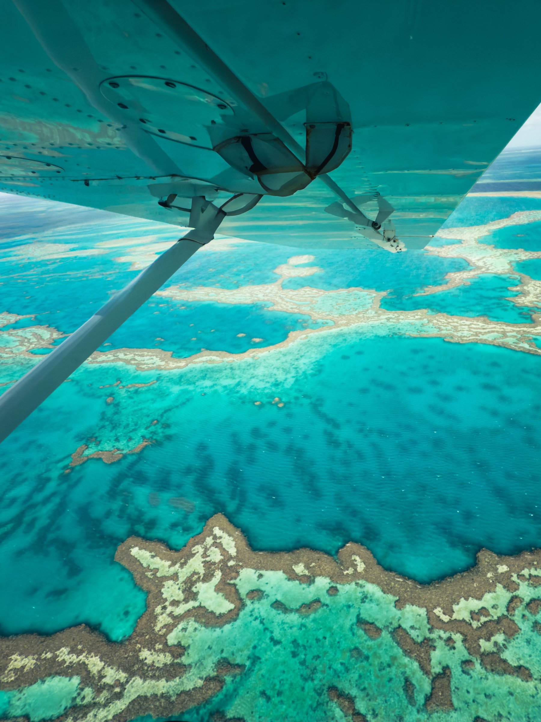
- Scenic flights: planes, seaplanes and helicopters show the reef's scale in under an hour, and Whitsundays flights pass over Heart Reef.
Our guide to choosing a Great Barrier Reef tour compares trip types, prices and what to ask an operator. Book outer reef trips a few days ahead in school holidays, and leave a spare day in case wind cancels your boat.
Where are the best snorkelling and diving sites?
The best sites cluster around the gateways: the outer ribbon reefs off Port Douglas and Cairns, the island bays of the Whitsundays, the SS Yongala wreck off Townsville and the coral cays of the southern reef. Our map shows 29 of them, numbered from north to south.
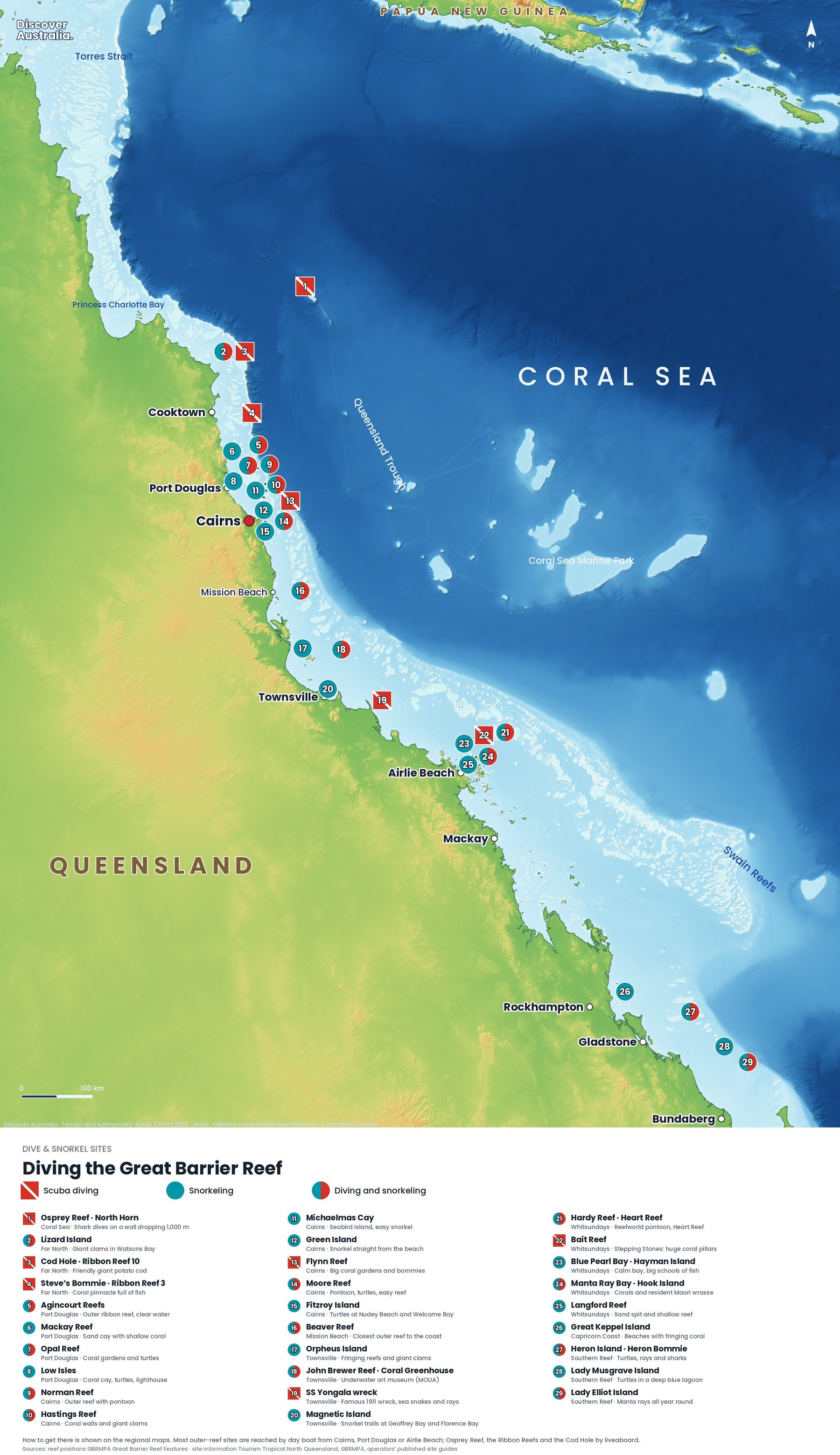
| Area | Sites (map numbers) | Best for |
|---|---|---|
| Coral Sea and far north | Osprey Reef North Horn (1), Lizard Island (2), Cod Hole (3), Steve's Bommie (4) | Liveaboard diving, walls, giant potato cod |
| Port Douglas | Agincourt Reefs (5), Mackay Reef (6), Opal Reef (7), Low Isles (8) | Clear outer ribbon reefs, easy lagoon snorkelling |
| Cairns | Norman (9), Hastings (10), Michaelmas Cay (11), Green Island (12), Flynn (13), Moore (14), Fitzroy Island (15) | Pontoons, first-timers, intro dives |
| Mission Beach to Townsville | Beaver Reef (16), Orpheus Island (17), John Brewer Reef Coral Greenhouse (18), SS Yongala (19), Magnetic Island (20) | Wreck diving, underwater art, shore snorkel trails |
| Whitsundays | Hardy Reef and Heart Reef (21), Bait Reef (22), Blue Pearl Bay (23), Manta Ray Bay (24), Langford Reef (25) | Sheltered island bays, sailing trips |
| Southern reef | Great Keppel Island (26), Heron Bommie (27), Lady Musgrave Island (28), Lady Elliot Island (29) | Turtles, manta rays, snorkelling from the beach |
For a description of each site, the depth, level and how to get there, read our full Great Barrier Reef snorkelling and diving guide. Before any reef swim, read up on ocean safety in Australia: tell the crew about any medical condition, and wear a flotation vest if you are unsure in the water.
What wildlife can you see on the Great Barrier Reef?
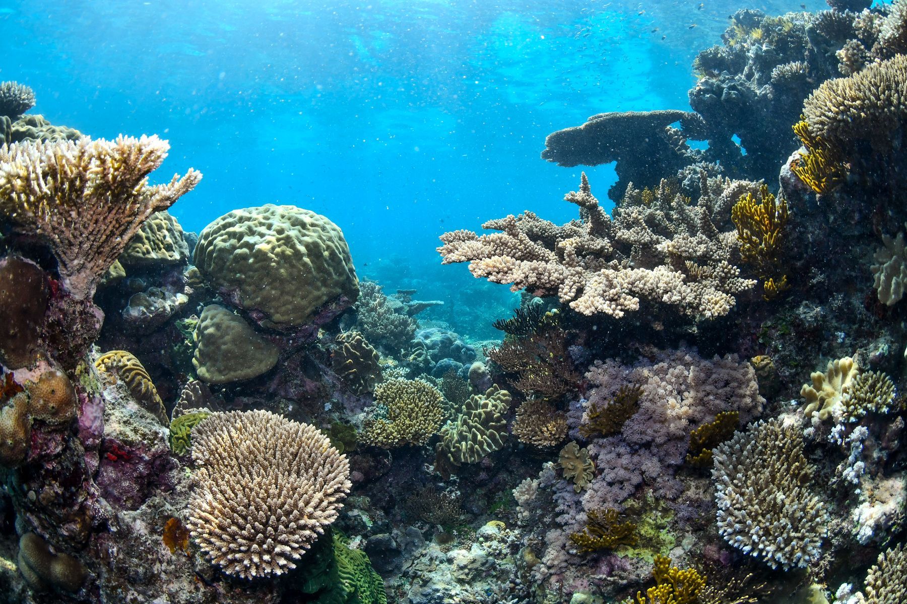
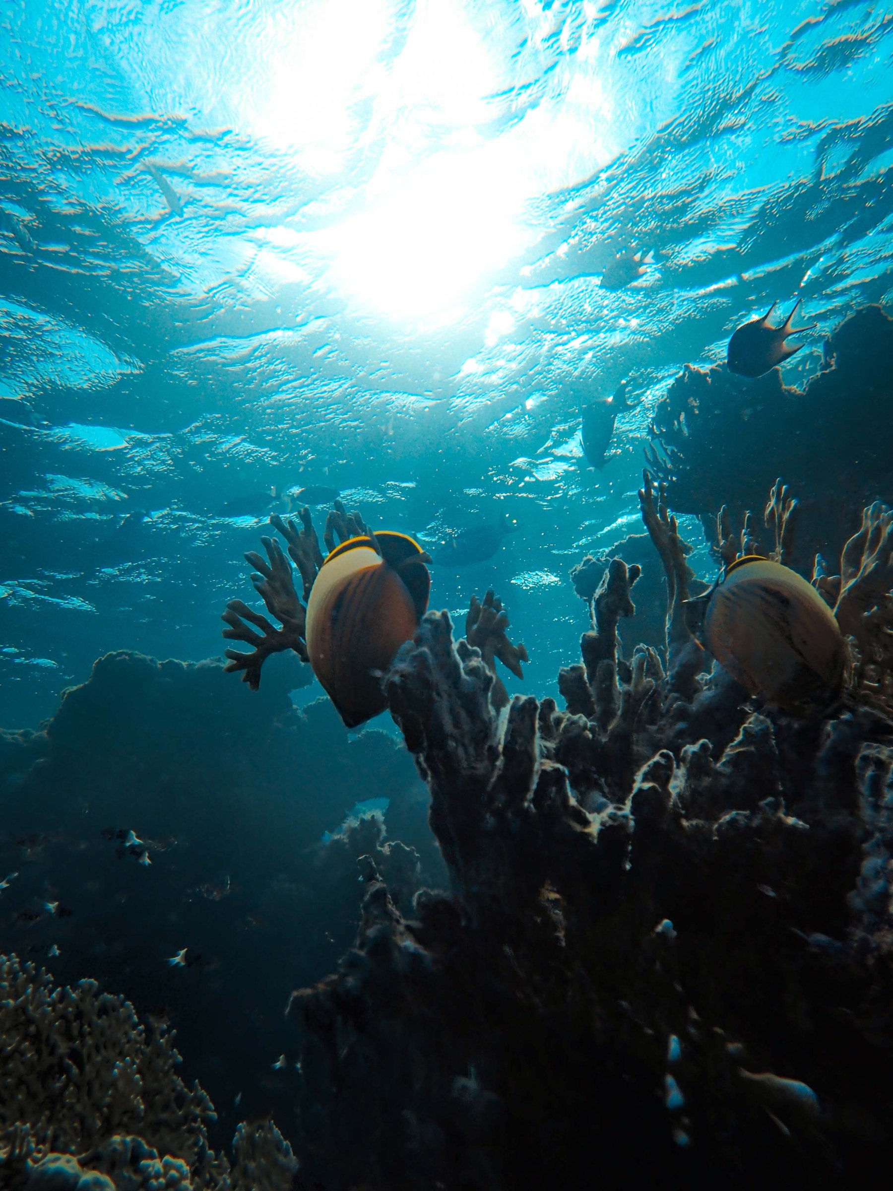
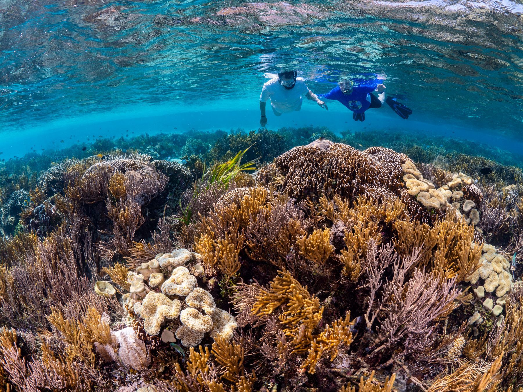
On almost any reef trip you will see colourful reef fish, giant clams and hard and soft corals, and turtles are common at many sites. Bigger encounters depend on where you are and the month.
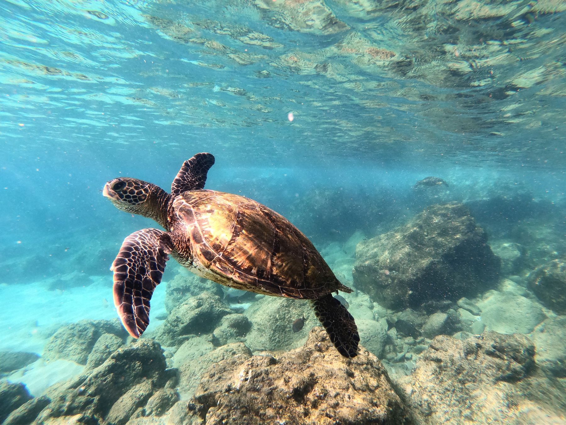
- Turtles: six of the world's seven marine turtle species live on the reef. Green turtles are the ones snorkellers meet most, at places such as Green Island, Low Isles, Heron Island and Lady Elliot Island.
- Turtle nesting: at Mon Repos near Bundaberg, loggerhead turtles nest from November to January and hatchlings emerge from January to March. Ranger-guided Turtle Encounter tours run from November to late March and must be booked.
- Manta rays: Lady Elliot Island is the best-known spot. Mantas are seen there all year, with winter the peak season.
- Humpback whales: they visit the reef from about May to September to calve and rest, and are often seen from Whitsundays boats in winter.
- Dwarf minke whales: in June and July they gather on the Ribbon Reefs north of Cairns, where some licensed liveaboards offer snorkel encounters.
For the best beaches and seasons for turtles across the country, see where to see sea turtles in Australia.
When is the best time to visit the Great Barrier Reef?
For most travellers, June to October is the best time: the weather is dry and mild, stinger season is over, and whales are passing. But you can snorkel the reef all year.
- Dry season (about May to October): lower humidity and mostly sunny days. Trade winds can make some crossings rough, especially in winter.
- Stinger season (typically November to May): dangerous jellyfish occur in tropical Queensland waters, so wear the lycra stinger suit your operator provides. Read about the real risks in dangerous animals in Australia.
- Wet season (about December to March): hotter, with heavy rain and the chance of cyclones, but calmer seas on many days and fewer crowds.
Our month-by-month guide to the best time to visit the Great Barrier Reef covers water temperature, visibility, wildlife and prices.
Is the Great Barrier Reef healthy?
The reef is under serious pressure, but it is not dead, and much of it is still worth seeing. Its biggest threat is marine heatwaves caused by climate change, which have bleached corals six times since 2016, according to the Australian Institute of Marine Science (AIMS). Between heatwaves, corals can recover.
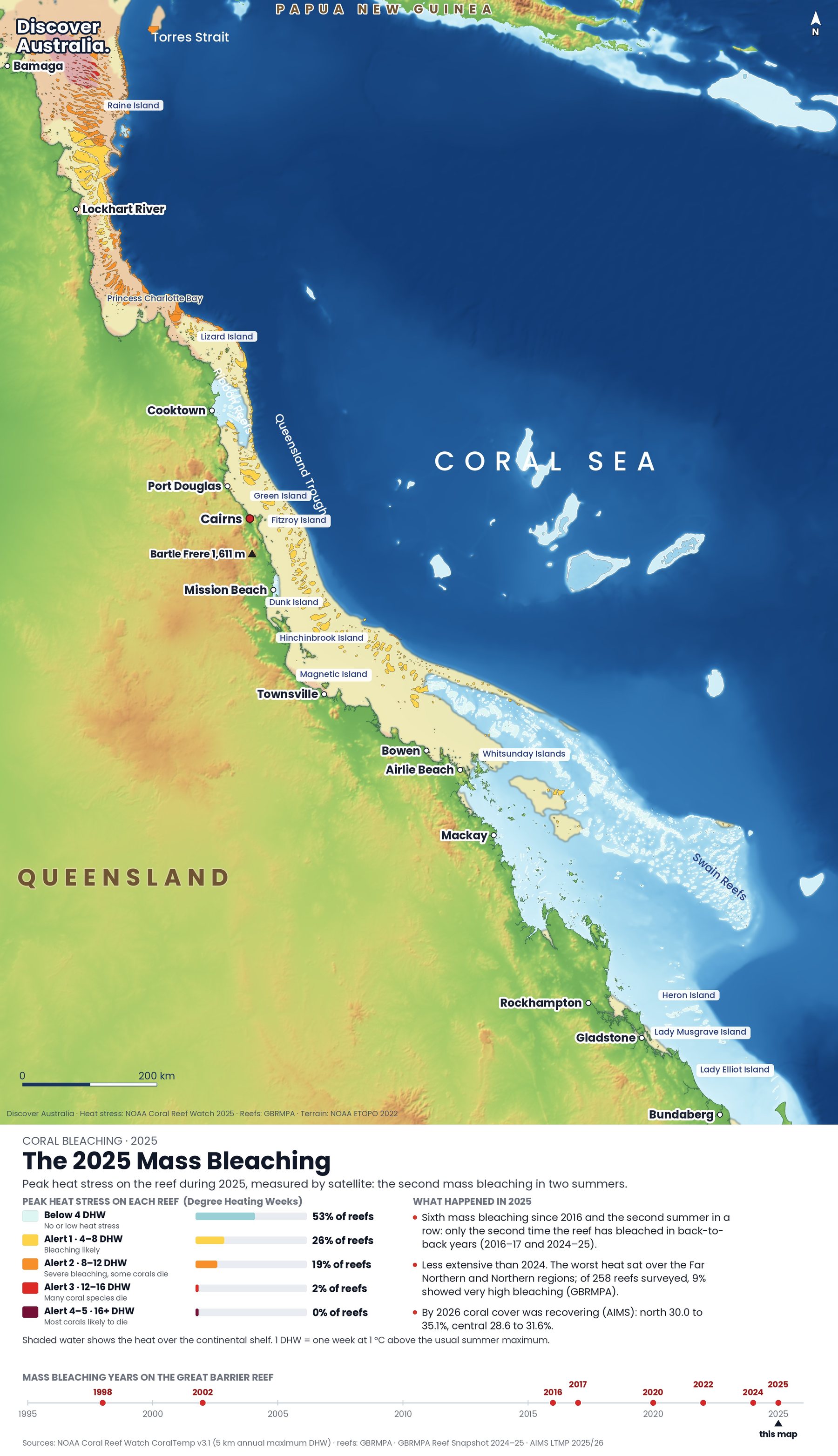
Coral bleaching happens when water stays too warm for too long. The coral expels the tiny algae that live in its tissue and give it food and colour, and turns white. Scientists track this heat with Degree Heating Weeks (DHW), a satellite measure from the US agency NOAA. Think of it as a running total: it adds up how much hotter than the usual summer maximum the water has been, week by week, over the last 12 weeks. At 4 DHW, bleaching becomes a risk. At 8 DHW, NOAA says reef-wide bleaching is likely, with heat-sensitive corals dying.
Our three maps show peak heat stress on each reef in three different summers.
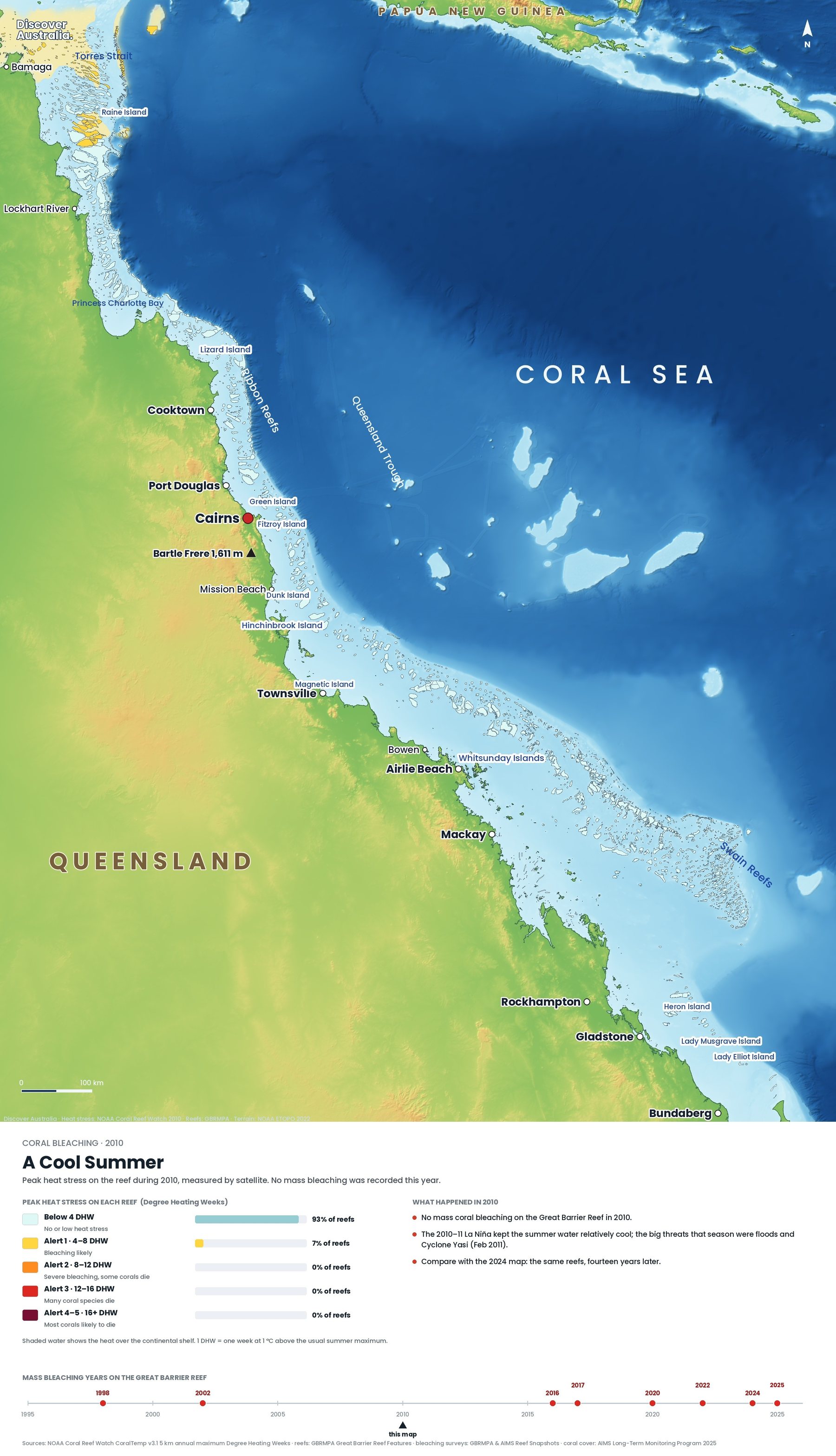
2010 was a cool summer for the reef. Almost every reef stayed below 4 DHW, and AIMS records no mass bleaching that year. The big threats that season were floods, not heat.
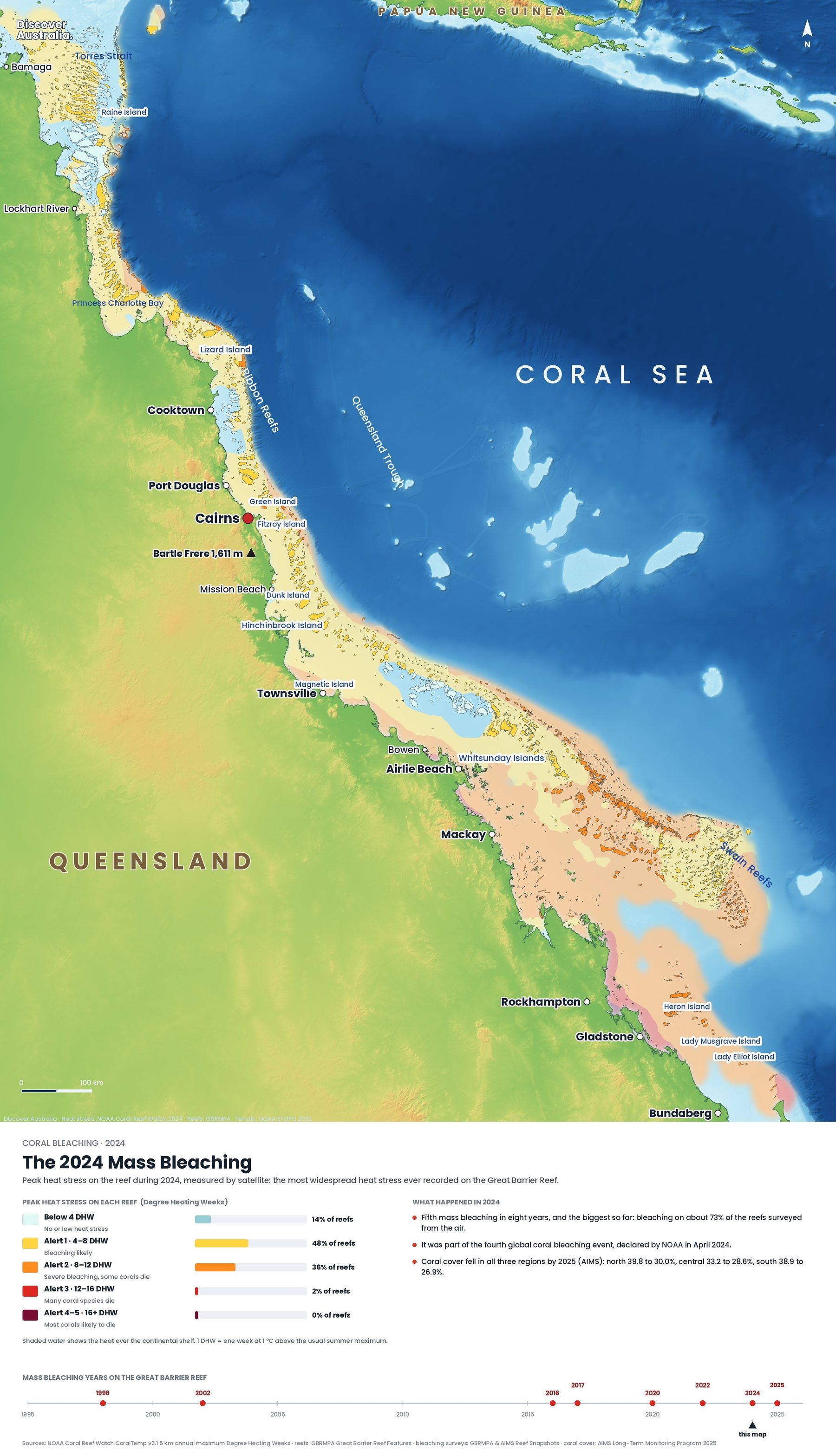
2024 was the opposite. AIMS says the bleaching had the largest footprint ever recorded on the reef, and aerial surveys of more than 1,000 reefs found bleaching on 73% of reefs surveyed in the Marine Park. It was the fifth mass bleaching since 2016, and part of the fourth global bleaching event that NOAA confirmed in April 2024.
2025 brought a sixth mass bleaching, but it was smaller and largely confined to the northern reef. It was only the second time the reef had bleached in back-to-back summers, after 2016 and 2017.
What did it cost? AIMS surveys from August 2024 to May 2025 found hard coral cover fell from 39.8% to 30.0% in the north, 33.2% to 28.6% in the centre and 38.9% to 26.9% in the south, the largest annual drop recorded in the north and the south. The next round of surveys, in 2025 to 2026, found only limited damage from the 2025 event: cover rose to 35.1% in the north and 31.6% in the centre, while the south held at 26.4%.
AIMS describes a reef that now swings quickly between highs and lows, as fast-growing corals recover and then bleach again. For the full story, read what happened in the 2024 bleaching, is the Great Barrier Reef dying? and our explainer on mass bleaching and how to help.
How can you visit the reef responsibly?
Choose a licensed operator, follow the Reef Authority's responsible reef practices, and leave the coral and animals untouched. Your fare already helps: operators collect the environmental management charge for every visitor, which goes towards managing the Marine Park.
| Environmental management charge | Now | From 1 April 2027 |
|---|---|---|
| Full day (3 hours or more) | A$8.50 | A$9.00 |
| Part day (under 3 hours) | A$4.25 | A$4.50 |
You pay it only once a day even if you use two operators, and children under four carried free are not charged.
- Never touch, stand on or hold the reef. Practise floating over sand first, and keep fins and gear clear of coral.
- Give animals space. Do not feed fish, stay more than one metre from giant clams and keep clear of free-swimming turtles, whales and sea snakes.
- At turtle nesting beaches, stay at least two metres from nesting turtles and from nests where hatchlings are emerging.
- Know the zones. Each zone has its own rules; in green zones all fishing and collecting is banned. Read Australia's marine parks explained.
- Use Eye on the Reef. The Reef Authority's free app lets you log GPS-tagged photos of wildlife, crown-of-thorns starfish, bleaching and pollution, and those reports help managers track the reef's health.
Explore more Great Barrier Reef guides
Every Discover Australia guide to the reef and the coast around it, in one place.
- Great Barrier Reef Map: Where It Is, How Big It Is and Its Main Regions (2027)
- Great Barrier Reef Snorkelling and Diving: Yongala and 17 Sites Mapped
- How to Choose a Great Barrier Reef Tour: Outer Reef, Islands and Liveaboards (2027)
- Best Time to Visit the Great Barrier Reef: Month-by-Month Guide (2027)
- The 2024 Great Barrier Reef Bleaching Explained, With Maps (2027)
- Is the Great Barrier Reef Dying? What the Latest Data Shows (2027)
- The Great Barrier Reef and Mass Bleaching: What Happened and How to Help
- Whitsundays Guide: Whitehaven Beach, Sailing and How to Visit (2027)
- Daintree Rainforest Guide: Cape Tribulation, Mossman Gorge and How to Visit (2027)
- Where to See Sea Turtles in Australia (and How to Do It Right)
- Where the Ocean Is Protected: Australia's Marine Parks Explained
- K'gari (Fraser Island) Guide: 4WD, Lake McKenzie, Dingo Safety and Tours (2027)
- Best Time to Visit Australia: A Month-by-Month Guide for 2027
- Dangerous Animals in Australia: The Real Risks and How to Stay Safe (2027)
Facts checked October 2026. Reef charges, tour prices, zoning rules and reef condition change; check with the Reef Authority, AIMS or your operator before you travel.
- Reef facts (Great Barrier Reef Marine Park Authority)
- Great Barrier Reef, World Heritage List (UNESCO World Heritage Centre)
- Traditional use of the Marine Park (Great Barrier Reef Marine Park Authority)
- Environmental management charge: what are the charges (Great Barrier Reef Marine Park Authority)
- Responsible reef practices (Great Barrier Reef Marine Park Authority)
- What is Eye on the Reef (Great Barrier Reef Marine Park Authority)
- Whales and dolphins (Great Barrier Reef Marine Park Authority)
- Whales and dolphins of the Coral Sea Marine Park (Australian Marine Parks)
- Mon Repos Conservation Park: things to do (Queensland Parks and Wildlife Service)
- The rays of Lady Elliot Island (Lady Elliot Island Eco Resort)
- Degree Heating Week product (NOAA Coral Reef Watch)
- NOAA confirms fourth global coral bleaching event (NOAA NESDIS)
- Reef snapshot details widespread coral bleaching, 2024 (Great Barrier Reef Marine Park Authority)
- Coral bleaching events (Australian Institute of Marine Science)
- Great Barrier Reef condition summary 2024–25 (Australian Institute of Marine Science)
- Great Barrier Reef condition summary 2025–26 (Australian Institute of Marine Science)