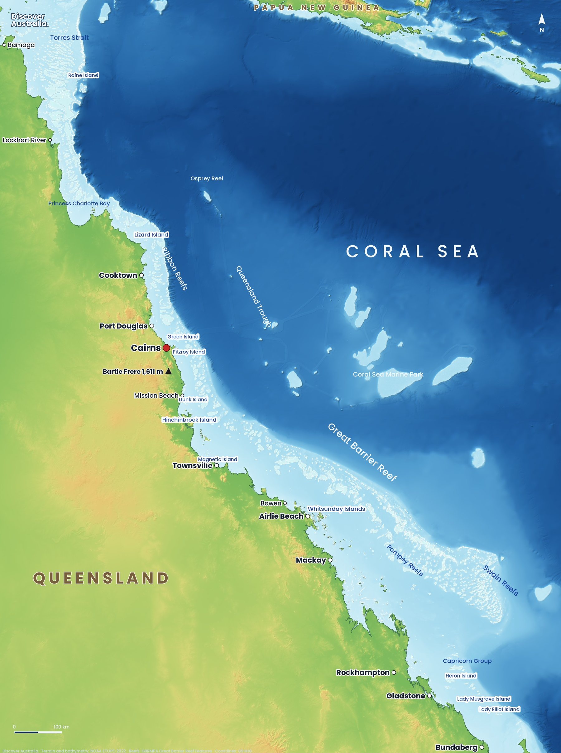
The Great Barrier Reef is not one reef but thousands, scattered along the Queensland coast from the tip of Cape York to just north of Bundaberg. Our map shows where it is, how its four regions divide up, which towns you leave from and why some reefs are a short boat ride away while others lie far out at sea.
Where is the Great Barrier Reef on a map?
The Great Barrier Reef lies off the north-east coast of Australia, in the Coral Sea, running along almost the whole coast of Queensland. It starts in the Torres Strait near Papua New Guinea and ends near Bundaberg, spanning 14 degrees of latitude, roughly 10°S to 24°S.
On our map, the light blue band is the shallow continental shelf where the reefs grow. The darker blue beyond it is deep ocean. Cairns, Port Douglas, Townsville and Airlie Beach sit on the mainland coast facing the reef.
For the bigger picture of reef trips, islands and wildlife, start with our Great Barrier Reef guide.
How big is the Great Barrier Reef?
The Great Barrier Reef Marine Park covers 344,400 km² and stretches about 2,300 km along the coast. That is a little smaller than Germany (about 357,600 km²) and bigger than Italy (about 302,000 km²).
The reef system is 60 to 250 km wide. The World Heritage Area, listed by UNESCO in 1981, is slightly larger, at about 348,000 km². Most of that area is open water: coral reefs make up only about 7% of the Marine Park.
Is the Great Barrier Reef one reef?
No. It is a chain of about 3,000 separate coral reefs, according to the Great Barrier Reef Marine Park Authority, ranging from small patches to reefs tens of kilometres long. Between them are channels, lagoons and sandy seafloor.
The Marine Park also holds about 600 continental islands (the tops of old drowned hills), about 300 coral cays made of sand and broken coral, and about 150 inshore mangrove islands. UNESCO counts over 900 islands in the World Heritage Area. Counts differ because sources draw the line between reefs, cays and islands in different places.
What are the main regions of the Great Barrier Reef?
The Reef Authority splits the Marine Park into four management areas, and they make a handy way to read the map from north to south.
- Far Northern: from the tip of Cape York to just south of the Howick Islands, north of Cooktown.
- Cairns/Cooktown: from the Howick Islands to just south of Mission Beach.
- Townsville/Whitsunday: from Mission Beach to Midge Point, south of Proserpine.
- Mackay/Capricorn: from Midge Point to the southern boundary near Bundaberg.
| Region | Gateway towns | Highlights | Distance offshore |
|---|---|---|---|
| Far Northern | No regular day trips; expedition cruises | Raine Island, Princess Charlotte Bay, Torres Strait | Raine Island about 120 km off Cape York |
| Cairns/Cooktown | Cairns, Port Douglas, Cooktown, Lizard Island | Ribbon Reefs, Cod Hole, Agincourt Reefs, Low Isles, Green Island | Low Isles 15 km, Green Island 27 km; outer reef about 50 km near Lizard Island |
| Townsville/Whitsunday | Townsville, Magnetic Island, Airlie Beach, Hamilton Island | Whitsunday Islands, Hardy Reef and Heart Reef, Hinchinbrook Island | Hardy Reef about 80 km east of Airlie Beach |
| Mackay/Capricorn | Mackay, Gladstone, Bundaberg | Pompey and Swain Reefs, Heron Island, Lady Musgrave, Lady Elliot | Capricornia Cays 60–100 km from Gladstone; Marine Park reaches 250+ km out |
Most visitors only see the Cairns/Cooktown and Townsville/Whitsunday areas, where the day-trip boats run. Our guide to choosing a Great Barrier Reef tour compares the gateways.
How far is the Great Barrier Reef from the coast?
It depends on where you are: from about 15 km offshore for inner reefs near Port Douglas to more than 250 km in the far south. The reef is closest to the mainland in the north and fans out further offshore as you head south.
- North: Low Isles is 15 km north-east of Port Douglas and Green Island 27 km from Cairns. Near Lizard Island, 30 km off the mainland, the outer reefs on the shelf edge are only about 19 km further out.
- Centre: Hardy Reef, home of Heart Reef, is about 80 km east of Airlie Beach, a two-hour boat ride.
- South: the Capricornia Cays lie 60–100 km north-east of Gladstone, and the Marine Park includes deep ocean more than 250 km offshore.
Distance matters on a trip: further reefs mean longer, bumpier boat rides and more chance of cancellations in strong winds. See the best time to visit the Great Barrier Reef for the calmer months.
What is the difference between the inner and outer reef?
The inner reef grows in the sheltered lagoon close to shore, while the outer reef lines the edge of the continental shelf, where the seafloor drops away to the deep Coral Sea. Outer reefs usually have clearer water and more ocean life; inner reefs and islands are closer and calmer.
In the north, the outer reefs formed as long, narrow strips along the shelf edge. The best known are the numbered Ribbon Reefs between Cooktown and Lizard Island, including Ribbon Reef No. 10 and its Cod Hole, famous for large potato cod. Beyond the shelf, the seafloor falls about 2,000 m. Further out, the Queensland Trough drops to around 2,600 m before rising to the Queensland Plateau, where the Coral Sea reefs sit.
Is the Coral Sea part of the Great Barrier Reef?
No. The reefs beyond the Queensland Trough belong to the separate Coral Sea Marine Park, a Commonwealth park run by Parks Australia. It covers 989,836 km², nearly three times the Great Barrier Reef Marine Park, and protects 34 reef areas and 67 cays and islets.
Its most famous reef for divers is Osprey Reef, more than 300 km from Cairns. It sits on top of a seamount that rises about 2,000 m from the seafloor, with walls dropping to about 1,000 m and visibility of 30 to 60 m. You reach it only on a liveaboard. Read more in our guide to Australia's marine parks.
Which famous reefs and islands are on the map?
Start with these, from north to south. Our second map numbers 29 dive and snorkel sites along the whole reef.
- Raine Island: on the outer edge of the far north, it has the world's largest remaining green turtle nesting population. It is closed to the public; see where to see sea turtles instead.
- Ribbon Reefs and Lizard Island: the northern outer edge, best reached by liveaboard.
- Low Isles and Green Island: coral cays close to Port Douglas and Cairns, easy for snorkellers. The coast here meets the Daintree Rainforest.
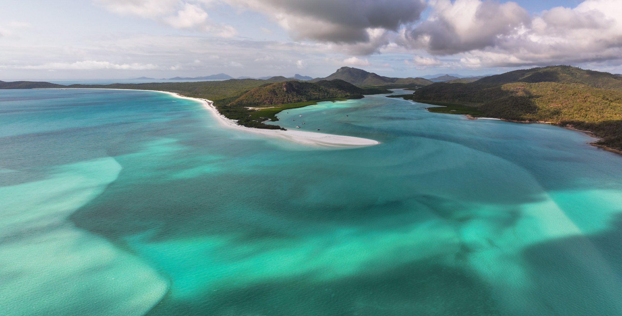
- Whitsunday Islands: continental islands off Airlie Beach, covered in our Whitsundays guide.
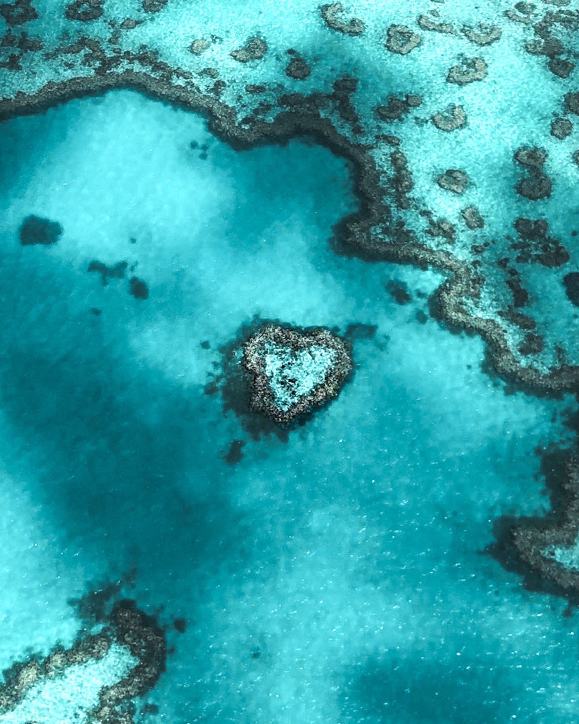
- Heart Reef: a small heart-shaped reef within Hardy Reef. It is protected, so you cannot snorkel or dive there; see it by helicopter, seaplane or plane.
- Pompey and Swain Reefs: dense mazes of outer reefs off Mackay and Rockhampton, far from day-trip routes.
- Capricorn and Bunker Groups: coral cays such as Heron Island and Lady Musgrave Island, with Lady Elliot Island at the reef's southern tip.
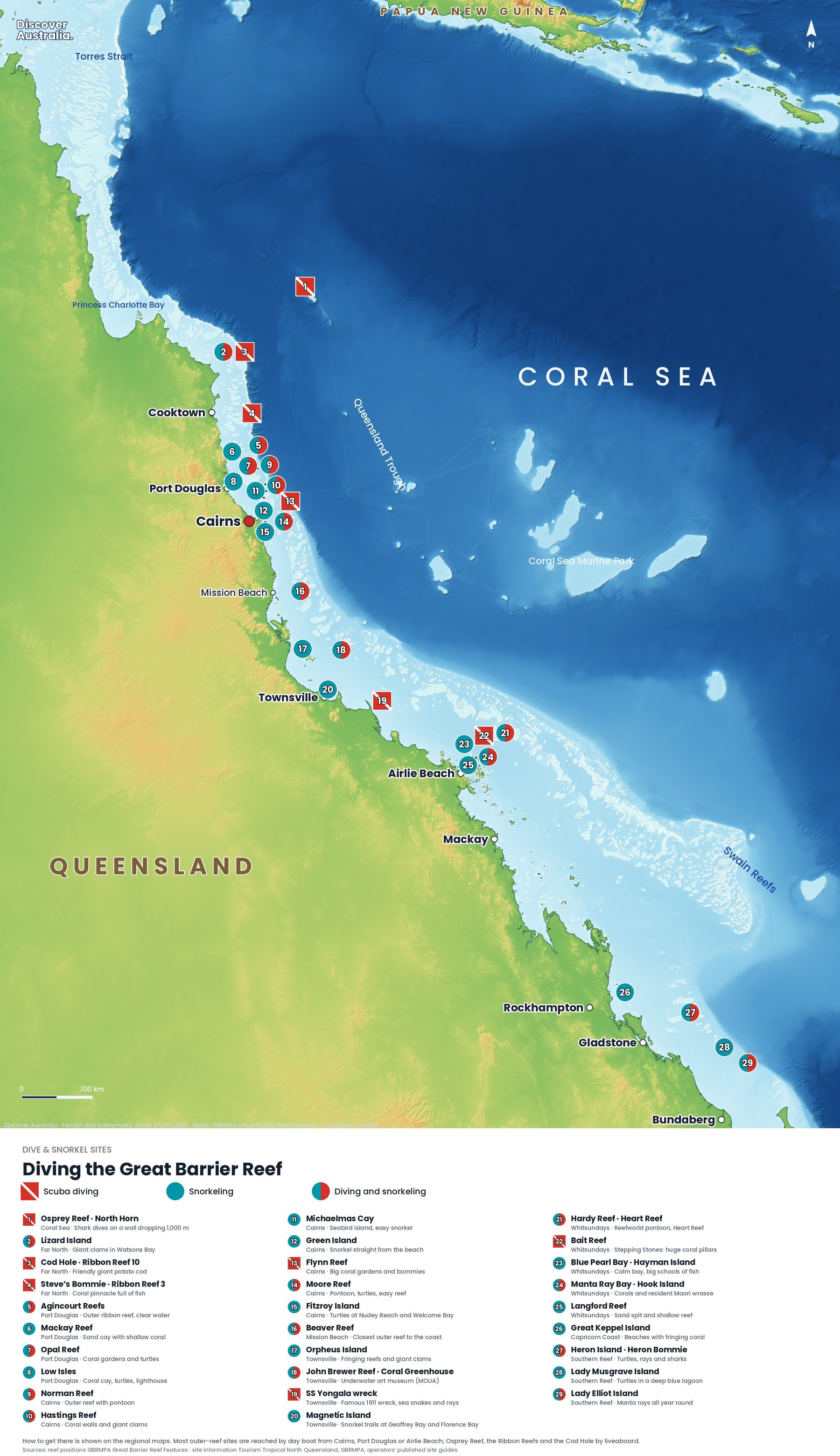
For what each site is like underwater, see Great Barrier Reef snorkelling and diving.
Can you see the Great Barrier Reef from space?
Yes. Astronauts on the International Space Station have photographed individual reefs, and NASA notes that reefs are easy to spot from space because their shallow, bright blue lagoons stand out against the dark, deep water around them. NASA's Landsat satellite images show long stretches of it in one frame.
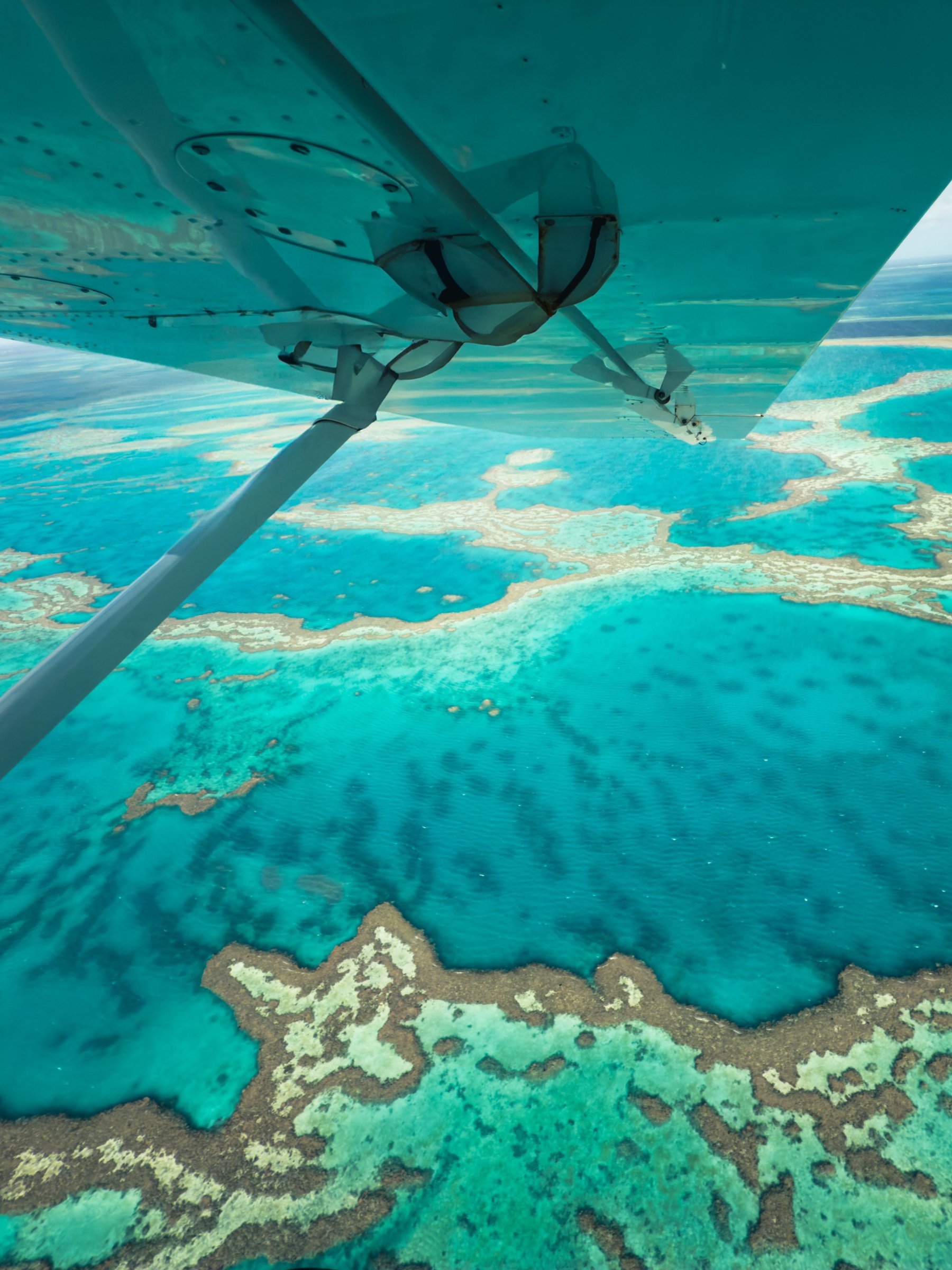
From a plane you get the same view up close. Scenic flights from Airlie Beach reach Heart Reef in about 30 minutes, and flights from Cairns cross the reefs off the coast. Satellite and aerial surveys are also how scientists track coral bleaching; our article on mass bleaching explains what they found, and our report on the 2024 bleaching covers the most recent surveys.
Facts checked October 2026. Distances are approximate and measured to the nearest mainland town; boat times depend on the vessel and the weather. Confirm access rules with the Reef Authority or Queensland Parks before you travel.
- Reef facts (Great Barrier Reef Marine Park Authority)
- Marine Park management areas (Great Barrier Reef Marine Park Authority)
- Great Barrier Reef World Heritage listing (UNESCO World Heritage Centre)
- Coral Sea Marine Park (Australian Marine Parks)
- Osprey Reef (Australian Marine Parks)
- How the Great Barrier Reef formed (Australian Institute of Marine Science)
- Location of Lizard Island Research Station (Australian Museum)
- About Raine Island National Park (Queensland Parks and Wildlife Service)
- Green Island National Park (Queensland Parks and Wildlife Service)
- Capricornia Cays National Park (Queensland Parks and Wildlife Service)
- Hardy Reef and Heart Reef (Tourism Whitsundays)
- Great Barrier Reef near the Whitsunday Islands (NASA Earth Observatory)